Earthquake near Soda Springs
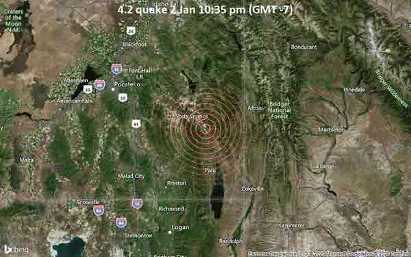
January 2, 2021, a 4.2-magnitude earthquake struck near Soda Springs, Caribou County, Idaho, USA. The tremor was recorded late at night on Saturday 2 January 2021 at 10:35 pm local time, at a very shallow depth of 3.2 miles below the surface.
The event was filed by the United States Geological Survey (USGS), the first seismological agency to report it. Our monitoring service identified a second report from the European-Mediterranean Seismological Centre (EMSC) which listed the quake at magnitude 4.2 as well. Based on the preliminary seismic data, the quake was probably felt by many people in the area of the epicenter. It should not have caused significant damage, other than objects falling from shelves, broken windows, etc. In Georgetown (pop. 470) located 7 miles from the epicenter, the quake should have been felt as light shaking.
Weak shaking might have been felt in Soda Springs (pop. 2,900) located 10 miles from the epicenter, Georgetown (pop. 190) 14 miles away, Soda Springs (pop. 900) 14 miles away, and Paris (pop. 510) 23 miles away. Other towns or cities near the epicenter where the quake might have been felt as very weak shaking include Preston (pop. 5,200) located 39 miles from the epicenter, Pocatello (pop. 54,400) 55 miles away, and Logan (pop. 50,400) 60 miles away.